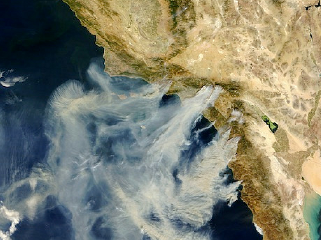
Seen from Space: Smoke from fourteen separate fi res streaks the skies during
Southern California’s 2003 Fire Siege. Most are clearly visible in this satellite view
taken at the height of the Cedar Fire, October 26, 2003. From north to south: the
Piru, Verdale, and Simi fi res north of Los Angeles; the Grand Prix and Old fi res near
San Bernardino; the much smaller Roblar 2 Fire near USMC Camp Pendleton; the
Paradise Fire in Valley Center; the Cedar Fire stretching across central San Diego
County, and the Otay Fire along the international border. A fi re can also be seen in
Mexico. Jacques Descloitres, Modis Rapid Response Team, Nasa GSFC


